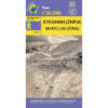


Helmos Vouraikos Hiking Map 1: 30,000
8,50 €
Description
Helmos Vouraikos Hiking Map 1:30 000
Hiking map for Mount Helmos and Vouraikos Gorge at a scale of 1:30 000.
Updated hiking map of Helmos on a scale of 1:30 000, the highest mountain in Achaia with an altitude of 2355m. The map covers the area from Lake Tsivlou and the forests of Zarouchla to the gorge of Vouraikos with the famous cogwheel railway, and from the springs of Aroani in the south, the ancient Kleitoria and the Cave of the Lakes to the ancient Lusou. From the fertile valley of Kerynitis and the panoramic view of Klokos and of course Mount Helmos (ancient Aronian mountains). An area with a landscape rich in beauty and history. The map shows the E4 route and many more hiking routes.
There are many paths in Helmos, but the most popular is the path from Kalavryta to Diakopto, crossing the Vouraikos gorge. From Diakopto take the cog railway up to Kalavrita.
The most impressive sight in Helmos is the waters of Styga flowing from the steep cliffs of Neraidorachi. In mythology, the Styx is the chthonic river that flows from the Underworld.
A more difficult route is the steep Htenia Helmou.
Don't miss the Cave of the Lakes (Cave of the Lakes), an impressive system of lakes inside a large cave. Also visit the mountain villages of Planitero, Peristera and Kalavrita, and in winter, the ski resort near Kalavrita, where the ski resorts have mythological names.
Additional information
| Publications | Anavasi |
|---|---|
| Year of publishing | 2020 |