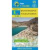


Milos Kimolos Polyvos Hiking Map 1: 31,000
5,50 €
Description
Milos Kimolos Polyvos Hiking Map 1: 31,000
Hiking map of the islands of Milos, Kimolos, Polyvos at a scale of 1: 32,000
Milos and its archipelago which also includes Kimolos, Polyvos, Erimomilos and the many smaller islands such as Akradies, Glaronissia etc. belong to the volcanic arc of the South Aegean.
They are volcanic islands with extremely interesting geological history and geology, which is of course reflected in their landscape. Places such as Paliochori, Sarakiniko, Papafragas, Kleftiko, Fyriplaka, Paliorema or Vani tell a story accessible only to the initiated through their unique geoforms or colors.
With this new map of the Ascent we suggest you to discover the wonderful coasts and the unique monuments of Milos on the one hand, and the wonderfully preserved hinterland of Kimolos, with the beautiful hiking trails, on the other.
An easy-to-use map printed on durable plastic paper, as always.
Additional information
| Publications | Anavasi |
|---|---|
| Year of publishing | 2020 |