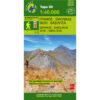


Zagori Valia Calda Metsovo Hiking Map 1: 40,000
8,50 €
Description
Zagori Valia Kalda Metsovo Hiking Map 1:40 000
Hiking map of Zagori, Valia Kalda and Metsovo on a scale of 1:40 000
Zagori – Metsovo – Valia Kalda 1:40 000 is a composite project that captures what is happening in the region in every field of rural activity. More than 10 mountain professionals in the area collaborated and contributed. This map is truly an essential tool for anyone traveling in the area.
It does not replace the Zagori 1:50 000 which has on the back side descriptions of the paths.
Two regions of North Pindos and two sides of the map. On one side the steep shining limestone mountains, deep gorges and stone villages of Zagori and on the other Valia Kalda enclosed in a labyrinth of dark mountains and wonderful forests. Imposing and majestic mountains, a precious refuge for both wildlife and those seeking the tranquility of ancient forests and crystal clear water. An inexhaustible field for hiking, with monumental stone-built paths and arched bridges or forgotten yidostrata.
The 46 traditional villages of Zagorochoria have now become famous outside the country's borders. Before they became accessible via paved road, the villages were only connected by mountain paths and stone bridges, some of these cobblestones still exist today and you will also find them on the map, such as Skala tou Bradetos.
Zagori is famous for the Vikos gorge and Drakolimni, in the heart of the Unesco Vikos-Aoos Geopark.
The most famous peaks in Tymfi are Gamila, Astraka and Goura.
Additional information
| Publications | Anavasi |
|---|---|
| Year of publishing | 2021 |