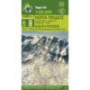


Gramos Smolikas Voio Vasilitsa Hiking Map 1: 40,000
8,50 €
Description
Gramos Smolikas Voio Vasilitsa Hiking Map 1:40 000
Hiking map for Gramos, Smolika, Voio and Vasilitsa on a scale of 1:40 000.
The highest peak is Tsuka Petsik with an altitude of 2520m. Gramos is the fourth highest mountain in Greece after Olympus, Smolikas and the North.
Almost inaccessible for decades after the civil war, the area is regaining the interest of travelers, as it offers an inexhaustible field for nature-loving and cultural explorations. The hiking map Gramos-Smolikas-Voio-Vasilitsa covers all Gramochoria and Akritochoria while in the northeast the map reaches Nestorio. To the south, Mastorochoria and Kastanochoria of Voio are covered with the wonderful chestnut forests. Otherwise several new hiking and dirt roads have been added to the map.
* Grammos or Grammos? The correct spelling is not certain, but the double "m" in Grammos would etymologically associate the mountain with the word "line"
Additional information
| Publications | Anavasi |
|---|---|
| Year of publishing | 2019 |